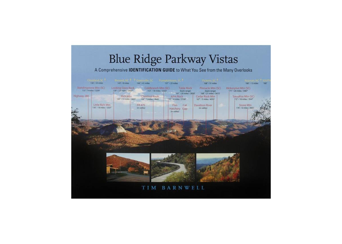
Have you ever wondered what mountain peaks you were actually seeing as you enjoy the view from one of the many beautiful overlooks along the Blue Ridge Parkway. Are you curious how high those mountains are and how far away one is from the other. This book is designed to answer those questions and much more. It is a driving guide to the Parkway, featuring views from more than 40 overlooks along its 469-mile track through North Carolina and Virginia, with information about what you are viewing, and nearby attractions such as waterfalls, visitor centers, craft shops, and museums. Author and photographer Tim Barnwell identifies the mountain peaks you can see from each overlook, marking their compass heading, distance, and elevation. Major roads, rivers, lakes, and towns are also identified. The book is easy to use- when you drive to a featured overlook, simply find the corresponding panoramic photograph made from that exact spot, and you will soon know the names of all the peaks you are admiring. Hikers will appreciate the book, too- it's great to be able to put a name to the mountain peaks you see from your favorite trail. In addition to the Parkway overlooks, the book also features numerous stunning views from popular attractions across western North Carolina, including the Biltmore Estate and Chimney Rock Park.